Is there a bridge between New Zealand’s North and South Island?…

Yesterday, I stumbled across the following video. If you’re interested in geography, this may appeal to you, along with today’s story:  https://youtube.com/shorts/-hSwHxNVoAU?si=wOYvewVJVmVWwVQL.

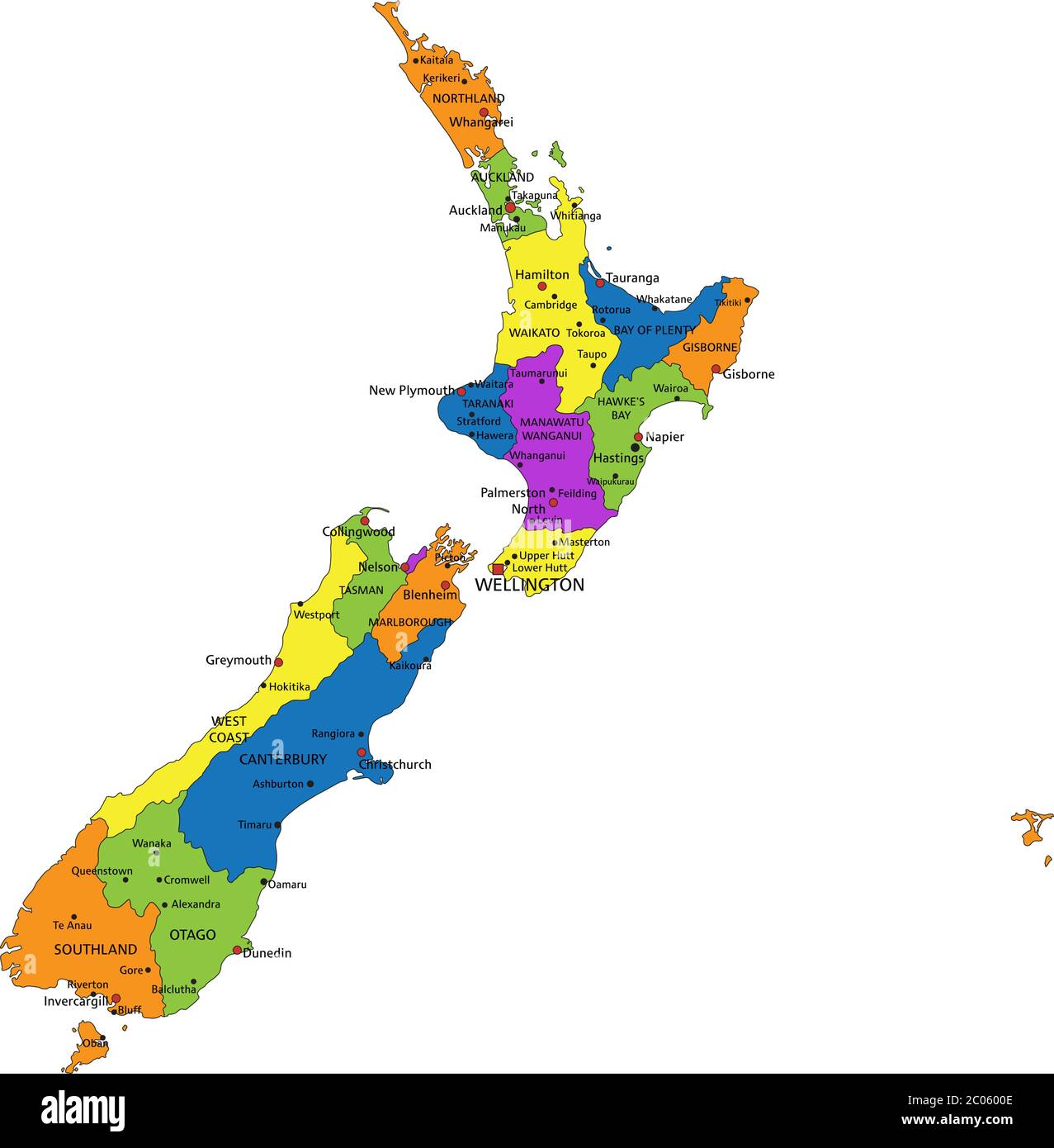
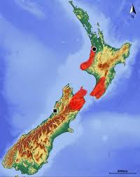
Standing on the edge of either island in New Zealand, it’s hard not to wonder why, after all these years, all this ingenuity, and all stubborn human determination, there is still no bridge stretching across Cook Strait. The question feels especially natural when one is living here, watching ferries inch across restless water, checking weather apps with fingers crossed, and quietly hoping the wind will hold just long enough for safe passage. And yet, the absence of a bridge isn’t an oversight. It’s a deliberate, deeply practical decision shaped by nature, history, and humility. The two islands are 14 miles, 22 kilometers apart.

Cook Strait is not a polite body of water. It is one of the most unpredictable and hostile stretches of sea in the world. Where the Pacific Ocean collides with the Tasman Sea, powerful currents squeeze through a narrow gap between the North and South Islands, accelerating with astonishing force. The tides reverse direction several times a day, creating swirling eddies, standing waves, and sudden surges that can catch even experienced sailors off guard. Add frequent gale-force winds, and Wellington is famously windy for a reason; it has an environment that resists permanent human structures.

Then there’s the depth. Cook Strait plunges to depths of more than 120 meters (nearly 400 feet) in places, far deeper than many of the world’s bridged waterways. Building bridge pylons would require anchoring into a seabed that drops away steeply and unevenly, making construction not just expensive but technically daunting. Unlike rivers or shallow channels, this isn’t a place where you sink supports and build upward. The sea floor itself seems to say, “Not here.”

New Zealand also sits astride the boundary of two massive tectonic plates, the Pacific Plate and the Australian Plate, which are in constant, grinding motion. Cook Strait lies directly within this seismic zone. Earthquakes are not a remote possibility; they are an accepted part of life. Any bridge would need to withstand powerful seismic activity while simultaneously enduring relentless wind, waves, and corrosion from salt spray. Engineering something that could survive all three in the long term would push even modern technology to its limits.

Cost, of course, looms large. Estimates for a Cook Strait bridge, or even a tunnel, run into tens of billions of dollars. For a country with a relatively small population (5.34 million), that kind of investment must be weighed against hospitals, housing, roads, and climate resilience. Ferries, for all their frustrations and delays, remain vastly cheaper and more flexible. They can be upgraded, replaced, rerouted, or paused when conditions turn dangerous, something a fixed structure can’t do.

There’s also a more philosophical reason. New Zealanders tend to respect the land and sea in a way that feels deeply ingrained. The Māori worldview, in particular, emphasizes balance, guardianship, and coexistence with nature rather than dominance over it. Cook Strait, known as Raukawa Moana by the Māori people, is seen not just as an obstacle to conquer, but as a powerful living entity in its own right. Sometimes, choosing not to build is a form of wisdom.

As travelers and temporary residents, we’ve come to see the ferries as part of life here and in many other parts of the world. Yes, they can be delayed. Yes, the crossings can be rough. But something is grounding about watching the coastline fade behind you, knowing that this stretch of water remains untamed. In a world obsessed with connection at any cost, New Zealand’s lack of a bridge across the Cook Strait feels like a quiet reminder: not every gap needs to be closed. Some are meant to be crossed with patience, respect, and a healthy acceptance of nature’s authority.

Be well.

Photo from ten years ago today, January 27, 2016:

“Ah, I’m so happy they stopped by to see us!” say these cows as we walked past in New Zealand. For more photos, please click here.

Is It Safe to Visit the Caribbean Right Now?…Alert to travelers…

The tiny free-range eggs we purchased at the grocery store the day we arrived, compared to the eggs we bought at the Taranaki  Farmers Market on Sunday. This morning, during the football game, I made Tom nitrate-free local bacon and three of these jumbo eggs, scrambled with cheddar cheese (referred to as non-processed Tasty cheese in both AU and NZ).

Note: During our remaining time in New Zealand, we’ll be reposting photos (including their original captions) from our previous stay, beginning in January 2016, when we were based in a far less remote location than where we are now in Kaiwaka, nearly a full day’s drive from most sightseeing destinations.

Today’s photos are from this post here.

Today’s post is an article from Travel and Leisure’s online magazine, here.

“Is It Safe to Visit the Caribbean Right Now? What Travelers Should Know

Some Caribbean islands remain under Level 1 advisories, but travelers should stay updated amid shifting conditions amid Venezuela tensions. By Michael CappettaPublished on January 6, 2026.

Recent military action in Venezuela and the closure of airspace in the region may have travelers questioning their upcoming vacation plans to the Caribbean. But between differing travel warnings from the U.S. Department of State and various flight concerns, there’s not a one size fits all approach for the large and diverse region.

Although many plants were still available, most of the produce had already been sold by the time we arrived, 90 minutes after opening. Next time, we’ll arrive at 9 am.

This is what travelers should know before a Caribbean trip, according to experts.

What happened in Venezuela and the Caribbean?

On Jan. 3, the U.S. initiated a military strike on Venezuela, capturing the country’s leader, Nicolás Maduro, and transporting him to New York to face narco-terrorism charges. Following that, the Federal Aviation Administration (FAA) temporarily restricted airspace around both the Caribbean and Venezuela, but has since reopened it.

The closure led to a ripple effect of flight disruptions with major airlines forced to add additional flights to accommodate stranded passengers. That’s what happened to Nydia Han, a consumer investigative reporter with Philadelphia’s 6abc, who was finally able to get a flight back to the Continental U.S. after getting stranded in Puerto Rico for days, taking a slight detour to Baltimore before boarding a train back to the City of Brotherly Love.

Tom eyeballed the bread and pastries and, as usual, but was able to resist.

“Positive update from the Caribbean—I was online and on the phone for HOURS all day yesterday but finally got flights so we will be heading home sooner than Friday,” Han wrote in an Instagram post, adding in the video, “We all recognize and realize fully that there are far worse places to be stuck. We’re lucky just to be able to have been here in the first place.”

The good news is flight disruptions have started to ease, Katy Nastro, a travel expert with Going.com, told Travel + Leisure.

“The risk of cancellation has decreased, but airport congestion and certainty of full flights have increased,” Nastro said, adding, “Airlines take the risk of flying in/out of these places as well and the last thing they need or want is to be making headlines about stranded passengers (again).”

Prices are reasonable for the baked goods when based on today’s rates; NZ$ 1 is equivalent to US$ 0.65.

Henley Vazquez, the co-founder of Fora Travel, told T+L the biggest issue for travelers with events like this is uncertainty. Thinking “outside the box” and flying into alternative airports may also help get travelers home.

“From a practical standpoint, travelers can take a few simple steps to stay prepared: save airline and hotel contact information for easy access, avoid tight connections or overly rigid itineraries, and build in buffer days for international returns,” Vazquez said. “Small measures like these can make a meaningful difference when plans are in flux.”

What does the government say about traveling to the Caribbean?

The State Department issues varying travel advisories for countries and destinations around the world ranging from the lowest Level 1 warning to the highest Level 4.

To the left are the organic acid-free tomatoes with organic regular tomatoes to the right, all priced at NZ $5, US $3.25 per batch as shown. We purchased both for comparison for future purchases. So far, the acid-free ones are winning at the same price.

Currently, Venezuela is classified under the department’s highest Level 4 warning, recommending Americans “do not travel” there “due to the high risk of wrongful detention, torture in detention, terrorism, kidnapping, arbitrary enforcement of local laws, crime, civil unrest, and poor health infrastructure. All U.S. citizens and Lawful Permanent Residents in Venezuela are strongly advised to depart immediately.”

The country of Haiti is similarly classified under a Level 4 warning along with several states in Mexico like Guerrero where Acapulco is located.

However, that is not the case for all destinations in the Caribbean. In fact, many have been recognized for their high safety standards like the island of Anguilla, which was recently named the safest country in the region by the World Population Review for its low crime rate. The State Department classifies Anguilla under its lowest Level 1 advisory, recommending Americans “exercise normal precautions” when going there.

A variety of vegetable and fruit plants and trees were offered for sale. Its summer here (comparable to July in the northern hemisphere).  Soon, more locally grown produce will be available.

Several other destinations are also listed under the same Level 1 advisory, including Antigua and BarbudaArubaBarbados, the Cayman IslandsDominica, the French West Indies (including St. Barts, Guadeloupe, Martinique, and Saint Martin), Saint Kitts and Nevis, and Saint Lucia.

The islands of the Bahamas and the Dominican Republic are listed at Level 2, recommending U.S. travelers “exercise increased caution” when heading there.

What can travelers do to minimize travel disruptions?

Beyond checking advisories, the State Department recommends all international travelers enroll in the free Smart Traveler Enrollment Program (STEP), which allows the department to send notifications, alerts, and relevant security information and allows the embassy to more easily reach travelers in an emergency.

Vazquez of Fora Travel also recommended travelers “make decisions based on their comfort level.”

“That means monitoring airline communications and government advisories closely, confirming plans directly with airlines and hotels, and making sure itineraries allow for adjustments if things change at the last minute,” she said. “It’s also important to review your travel insurance coverage and policies so there are no surprises if delays or rerouting become necessary.”

Vazquez added: “This is a moment to prioritize preparedness over spontaneity. Travelers don’t necessarily need to cancel plans right away, but instead should evaluate what feels right for them while staying up-to-date on the latest information.””

Be well.

Photo from ten years ago today, January 7, 2015:

Clouds obscuring a pie slice of last night’s moon in Hawaii. For more photos, please click here.

Map with our location in New Zealand…Why did we choose the North Island for our second visit in almost ten years?…

We are located in the top orange section in Northland on this map. A ferry is required to get from the North to the South Island.

When people hear that we’re spending time in New Zealand, the reaction is almost always the same. Their eyes light up, and they say, “Oh, the South Island!” as if there is no other possible answer. In many minds, New Zealand is synonymous with snowcapped mountains, turquoise lakes, dramatic fjords, and cinematic landscapes made famous by films and travel brochures. And yes, the South Island is undeniably beautiful. But beauty, we’ve learned over years of long-term travel, is only one piece of the puzzle. Livability is another. And for us, at this stage of our lives, that quieter consideration matters more than ticking off iconic views.

New Zealand’s two main islands are strikingly different, not only in landscape but in temperament. The South Island feels grand, wild, and often untamed. Distances are long, towns are small and far apart, and much of the land feels designed for short-term awe rather than daily living. It is a place that invites road trips, hiking boots, and a sense of adventure that thrives on motion. The North Island, by contrast, feels softer and more lived-in. It rolls rather than towers. It hums rather than roars. Life here feels less like a spectacle and more like a manageable pace.

The climate alone makes a noticeable difference. The North Island is warmer, more temperate, and generally more forgiving year-round. Winters are milder, especially in coastal and northern regions, and daily life doesn’t grind to a halt with snow or icy roads. The South Island’s colder winters, particularly in inland and southern areas, can be beautiful. Still, they also come with real challenges such as heating costs, damp homes, and limited services in rural regions during the off-season.

Cost of living played an equally important role in our decision. While New Zealand is not overly inexpensive anywhere, the South Island, particularly popular areas like Queenstown, Wanaka, and parts of Christchurch, can be surprisingly costly. Housing prices and short-term rental rates are often inflated by tourism, and many services are priced accordingly. Groceries can be more expensive due to longer supply chains, and dining out often feels like a luxury rather than a casual pleasure. The North Island, especially outside of Auckland, offers more flexibility. There are more towns, more options, more competition, and that translates into slightly lower costs and better availability of everyday essentials.

Healthcare access was another deciding factor, one we no longer take lightly. The North Island has a higher concentration of hospitals, clinics, and specialists. For those living with ongoing health considerations, proximity matters. In the South Island, particularly in remote or scenic regions, medical care can mean long drives or limited availability. While that may be manageable for short stays, it’s less appealing for long-term living, where predictability and access bring peace of mind.

There’s also the matter of community. The North Island feels more populated, more diverse, and more connected. It has a balance of rural charm and urban convenience that suits a slower, steadier lifestyle. Markets, small cafés, local events, and everyday interactions feel woven into daily life rather than existing solely to serve visitors. The South Island often feels oriented toward those passing through, hikers, skiers, and photographers, rather than those settling in for a while, like us.

That doesn’t mean we don’t admire the South Island. We do. Deeply. It’s a place we would happily visit again, explore, and photograph. But living somewhere is different from admiring it. We’ve learned, sometimes the hard way, that the places that look most spectacular in photos are not always the easiest places to live well. Beauty can be demanding. It can require effort, endurance, and constant movement. Right now, we value ease. We value warmth, access, and the ability to settle into ordinary days without friction.

Choosing the North Island wasn’t about settling for less. It was about deciding what fits us best. After years of travel, we’ve become less interested in what’s “most desired” and more attuned to what’s most supportive. The North Island offers us a gentler pace, manageable costs, better access to what we need, and a sense of everyday livability that aligns with where we are now. And in the end, that quiet alignment feels far more luxurious than any even more dramatic view.

We are soon off for Whangarai to the supermarket. We’re both still under the weather and weak from days of much-needed rest, but we will do our best to get everything we need for the next few weeks.

Be well.

Photo from ten years ago today, December 22, 2015:

When we played bingo at the Princeville Senior Center last March, while living in Kauai, Tom always had a great time. For more photos, please click here.